
North Kazakhstan Tourism Destinations
Northern Kazakhstan includes Pavlodar, Akmola and Kostanay Oblasts. This region is situated in the utmost northern part of the Republic, in the basin of the Esil, the Tobil and the Obagan rivers. From the west to the east, Northern Kazakhstan occupies the territory of more than 1300 km, and from the north to the south – about 900 km.
The main rivers are the Irtish and its two tributaries – the Esil and the Tobol. The largest lakes are Kusmurin and Sari Kopa in Kostanay Oblast, Tengiz and Korgaljin in Akmola Oblast, Shagala, Shortan and Burabay in North Kazakhstani Oblast.
Some of the lakes are famous for their medicated mineral salts and muds (Moyildi Lake in Pavlodar Oblast and Maybalik Lake in North Kazakhstani Oblast). The climate here is sharply continental, however, it differs from the other regions of the Republic in milder summer and lower winter temperatures.
Unique landscapes of Kokshetau mountains, woods and lakes, situated on the territory of “Burabai” National Nature Park; exotic caves of Bayanaul in south, richness of flora and fauna of Korgaldjin Nature Reserve can provide you a real chance to feel yourself a part of a virgin nature.
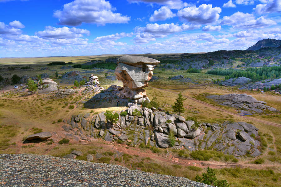
Relief
Some parts of Kokshetau Hills are: Kokshetau mountains (the highest peak is 947m), Ereimentau (899m), Zhaksy-Zhangyztau (730m); Atbasarska and Siletinskaya planes; and Tengiz-Korgalzhin hollow are situated in the territory of the Republic.
Flora and soil
Usual, southern and carbonite black soils with feather-grass flora and birch-coniferous forest massifs are in the north part of the oblast. The dark chestnut, chestnut and light chestnut soils with feather-grass flora, small islands with pine-birch forests are in the south part of the oblast.
A large recreation zone including sanatorium health resort complex of the republic means was founded on the base of mountainous pine forests. There are also such reserves as: Korgalzhin National Park, Ereimentausky, and Atbasarsky; Borvskoye and Zerendiskoye hunting farms, where hunters settle and acclimatize different kinds of animals and birds.
The rivers, lakes and reservoirs represent the water objects of the oblast. The largest rivers are: Ishim, Nura, Silety, Kulanotpes; the lakes are: Tengiz (1162sqkm), Kypshak (64,7sqkm), Kerei (63sqkm), Kozhakol (60,7sqkm); the reservoirs are: Viacheslavskoye (the area is 60,7sqkm, the capacity is 410,9mln cubic meters), and Siletinskoye (the area is 36,3sqkm, the capacity is 221,8mln cubic meters). The main minerals are: ores of non-ferrous and black metals, uranium; it is the place of such deposits of building materials as: a coal, cobalt, and kaolin; and of mineral waters and medicinal mud.
Transport and communication
The exploitation line of the railways was 1588km or 11,3% from the railway stretch in the Republic. The strength of the motorways with hard covering of common use is 64,7km for 1000sqm